Owl Farm Time Machine
Data Sources:
City of Bellingham GIS - CityIQ
Google Earth
Tools:
ArcGIS Online
Q-GIS
Google Earth Pro

Data Sources:
City of Bellingham GIS - CityIQ
Google Earth
Tools:
ArcGIS Online
Q-GIS
Google Earth Pro
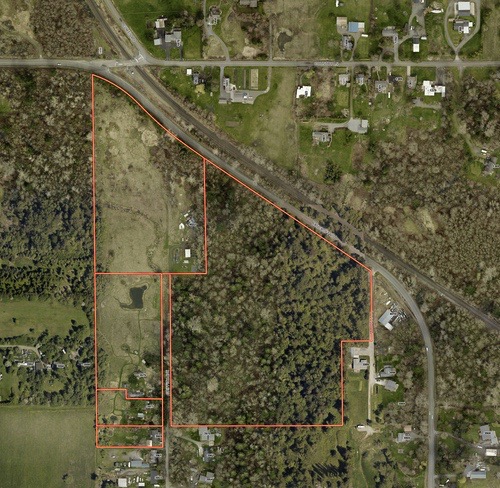
The first step was to use the City of Bellingham online GIS viewer called CityIQ
Owl Farm parcels were identified in this public information database via the land owners name, and a current aerial view was added to the scene to verify the property and adjacent features.
https://maps.cob.org/geviewer/Html5Viewer/Index.html?viewer=cityiq

The GeoTIFF of the parcels was opened in QGIS, a new ShapeFile layer was created, and parcels were manually traced. The lines separating adjacent parcels were dissolved to build a single parcel ShapeFile. This layer was then exported as a ShapeFile for the next step of importing it to Google Earth Pro (GEP).
https://qgis.org/en/site/index.html
https://www.google.com/earth/about/versions/
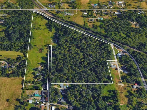
The last step in preparation of building the Time Machine Gallery was to import the ShapeFile of Property Boundary into Google Earth Pro. GEP is compatible with the ESRI ShapeFile format, so the process was fast!
From within GEP there is a tool which provides an index to their entire library of aerial view imagery. For Owl Farm this stretched from the earliest black and white air photo shot in 1941 until he most recent satellite image on June, 2023.
The following are 18 aerial images across this timeline. Each preview can be expanded to the highest resolution (8192 × 5983 pixels ) exported from Google Earth Pro.
https://www.google.com/earth/about/versions/
UPDATE: I have started converting older air photos that I found in the USGS website. Using QGIS, I Georectify, that is I transform the original air photo JPEG image to match the latitude and longitude of the parcel maps and then convert the JPEG into a GeoTIFF. The output is saved from QGIS after adding the property boundary lines.
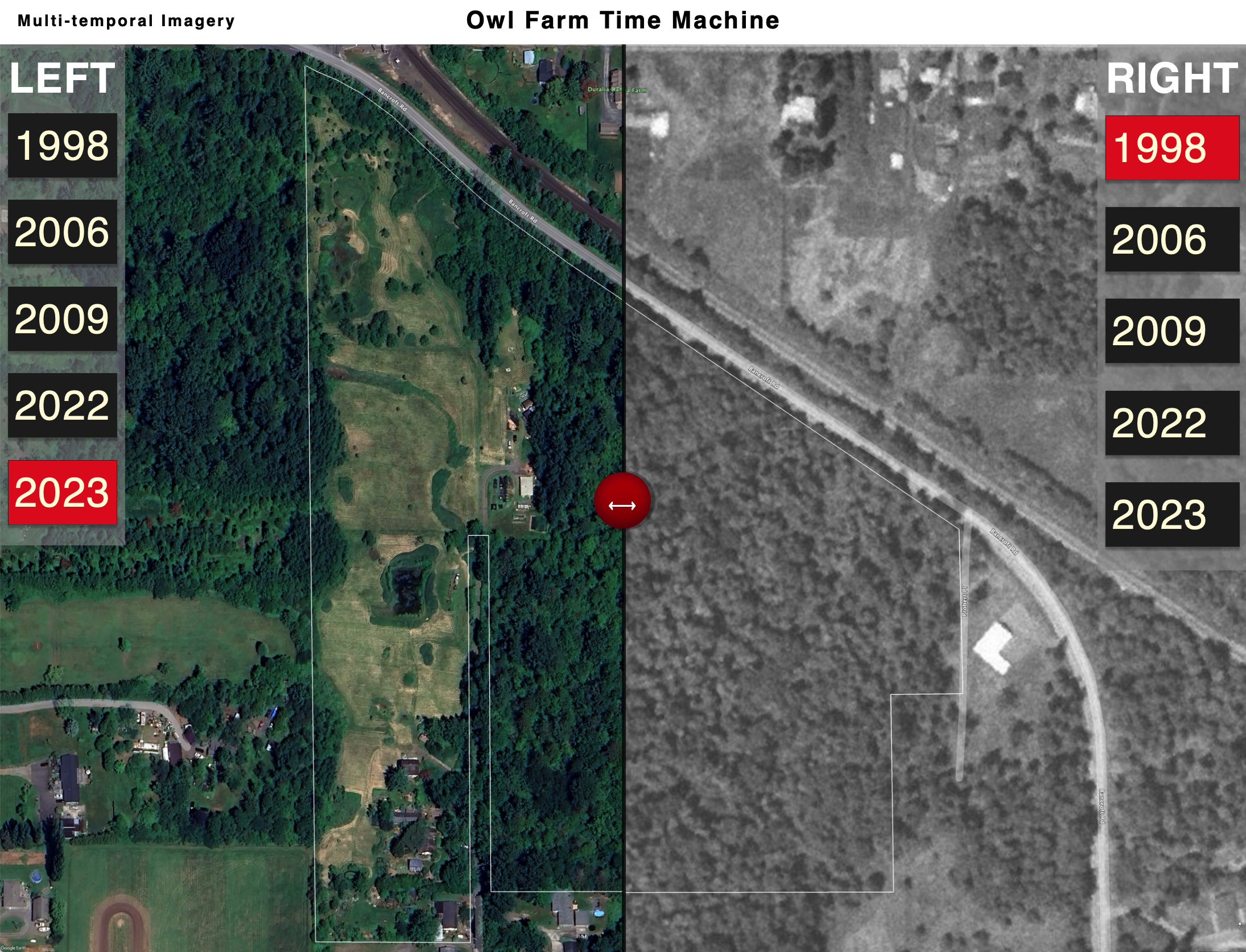
I been working on a Comparison Tool to make viewing and comparing images much easier. I've always enjoyed those image sliders that interactively overlay one image on top of another in order to see whats changed. This is a perfect application for an Aerial Photo Gallery like this. After testing a number of examples of sliders I came across one from a programmer named Louisa (https://www.loet.io) who was sharing a project on github that was very close to what I had been looking for. At some point I'll want to use drop down menus on the left and right side tabs to select photos , but in the interim give this a try. Click on a year on each side to compare and drag the red button to start exploring.
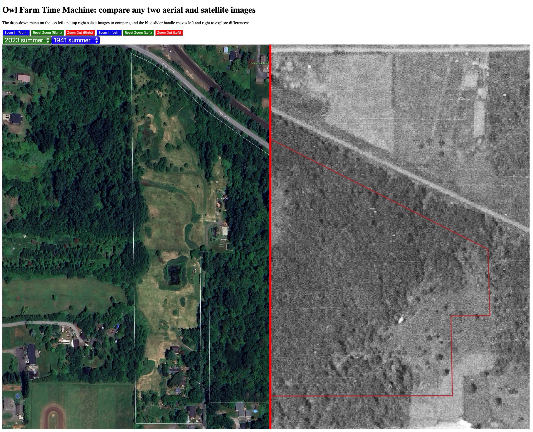
This version is very much in beta, which means I'm making changes and it may not work well at times. But if you are curious follow along.
History: current version is compare_zoom_v2
added scroll bars for panning, zoom using mouse wheel that zooms both images simulataneously.
Issues: cursor tool-tip grasping hand does not work for panning images. Image container does not allow panning full image, only the zoomed in view.